DESTINATION | Tianshan Mountains & The Heavenly Pond, Xinjiang
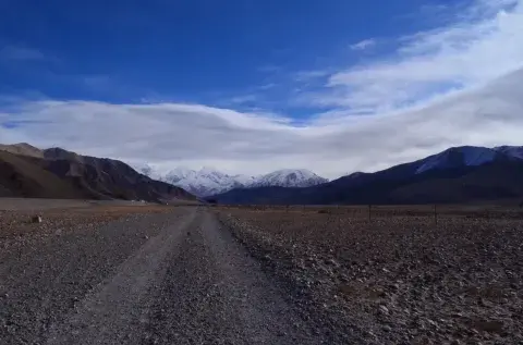
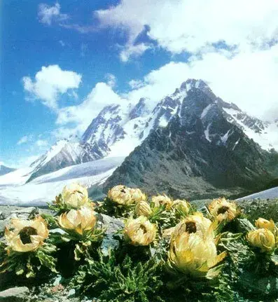
Tianshan Mountains is a well-known tourist attraction. The total length is 2,500 kilometers and the mean altitude is 1928 meters.
Tianchi, or the Heavenly Pond, is dubbed "the Pearl of the Tianshan Mountains". It is located in Fukang City of the Changji Hui Autonomous Prefecture, 110 kilome...
Tianshan Mountains is a well-known tourist attraction. The total length is 2,500 kilometers and the mean altitude is 1928 meters.
Tianchi, or the Heavenly Pond, is dubbed "the Pearl of the Tianshan Mountains". It is located in Fukang City of the Changji Hui Autonomous Prefecture, 110 kilometers east of Urumqi.
The Heavenly Pond abounds with wildlife and other natural resources with an area of 4.9 square kilometers.
The Heavenly Pond is a Four-A-Grade scenic spot approved by the State Council and listed in Bogeda Man & Nature Biosphere Reserves by UNESCO.
private car; bus

Xinjiang's Colorful Beach
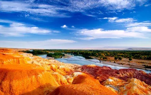
Nearly all of the rivers in China empty into the East China Sea. The only exception is the Ertix River, which lies to the north of the Dzungarian Basin in the Altai region of Xinjiang. Unlike the other rivers of China, the Ertix river flows northward to empty into the Arctic Ocean. Along the way ...
Nearly all of the rivers in China empty into the East China Sea. The only exception is the Ertix River, which lies to the north of the Dzungarian Basin in the Altai region of Xinjiang. Unlike the other rivers of China, the Ertix river flows northward to empty into the Arctic Ocean. Along the way the Ertix meets with many tributary streams as it meanders out of China from the southeast to the northwest, eventually even entering Kazakhstan. It joins the Ob River in Russia, and flows northward to the Arctic Ocean. The Ertix River is the largest river in Xinjiang, stretching over 4,248 kilometers, and is second only to the Ili River in water capacity.

DESTINATION | Kanas Lake, Altai, Xinjiang
Surface area44.78 km²Max. depth184 mSurface elevation1,340 m
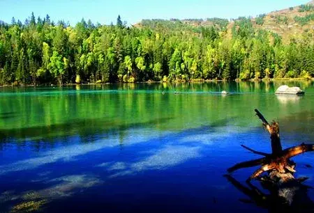
Kanas Lake (Chinese: 喀纳斯湖; pinyin: Kānàsī Hú) is a lake in...
Surface area44.78 km²Max. depth184 mSurface elevation1,340 m
Kanas Lake (Chinese: 喀纳斯湖; pinyin: Kānàsī Hú) is a lake in Altay Prefecture, Xinjiang, China. The lake is located in a valley in the Altai Mountains, near the very northern tip of Xinjiang, and the province's borders with Kazakhstan, Mongolia, and Russia. It is China's deepest freshwater lake.
The Kanas River, flowing out of the lake, later merges with other stream to form the Burqin River, which in its turn falls into the Irtysh in Burqin County.
There is a large population of Tuvans in the area.
About 117 different kinds of birds live along the lake.
There have been sightings of large lake creatures in the waters. A video was taken and shown in the local Chinese media where numerous unidentifiable creatures can be seen. According to CCTV10, the creatures living in the lake are speculated by Chinese scholar as giant Hucho taimen.
private car; bus; flight

Jiangbulak Scenic Spot in Xinjiang
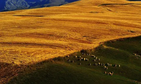
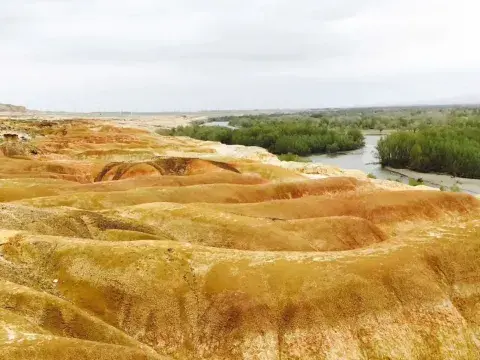
Located 60 km south of Qitai County, Jiangbulak Scenic Spot is a vast grassland in the eastern part of Tianshan Mountain. Its unique location endows it with beautiful landscapes, without any extreme weathers in the summer or winter.
Jiangbulak means the "source of holy water" in...
Located 60 km south of Qitai County, Jiangbulak Scenic Spot is a vast grassland in the eastern part of Tianshan Mountain. Its unique location endows it with beautiful landscapes, without any extreme weathers in the summer or winter.
Jiangbulak means the "source of holy water" in the Kazakh language. The spot boasts amazing natural scenes. The best season to visit Jiangbulak is June or July. Various flowers in different colors, massive barley fields, crystal lakes, and multi-peaked mountains abound.

DESTINATION | Yili, Xinjiang
Lying at the north foot of the Tianshan Mountain, Ili Kazak Autonomous Prefecture is in the west of Xinjiang Uygur Autonomous Region, bounded on the northeast by Russia and Mongolia, on the west by Kazakhstan.
Physical Features:
Ili is located in the heart of Central ...
Lying at the north foot of the Tianshan Mountain, Ili Kazak Autonomous Prefecture is in the west of Xinjiang Uygur Autonomous Region, bounded on the northeast by Russia and Mongolia, on the west by Kazakhstan.
Physical Features:
Ili is located in the heart of Central Asia. The Tianshan Mountains, the Altai Mountains, the Poluokenu Mountains, the Junggar Basin and the Monglkvre-Tekes Basin make up the main landforms of Ili, along with the Ili River, the Erqis River and their valleys.
Climatic Features:
The prefecture enjoys a cool, temperate, semi-arid, continental climate. Owing to the vast expanse of land, there are also microclimate features in different regions. Generally, Ili's summers are short and the winters, long. The temperature varies greatly between day and night. The temperature in spring rises rapidly but unstably, while the autumn temperatures drop rapidly.
When to Go:
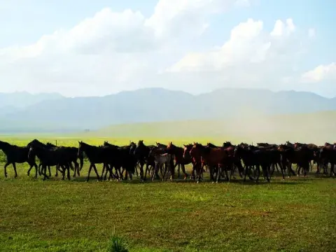
Summer and autumn are the best time in Ili. The pastures are verdant. Melons and fruits are ripe. Notable is the sunset in Ili River. It is the favorite of many photographers.
Special Local Products: lavender and black currant.
Scenic Spots is one of the most beautiful scenic spots in Xinjiang. The terrain is steep and wildlife ranges up and down the gorge.
Sayram Lake: is the largest and highest alpine lake in Xinjiang. Surrounded by the vast verdant grassland, it is a stunning attraction definitely worth visiting.
Nalati Grassland: is one of the four largest alpine meadows in the world.
Kanas Lake: is a mysterious lake, attracting numerous visitors, not only for its enthralling scenery and clear water, but also for the enchanting legend about the monster in the lake.
Travel Tips:
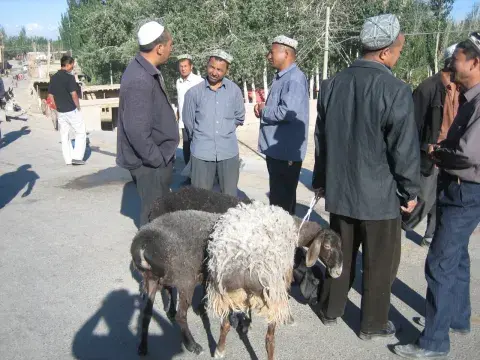
Kazak is the largest ethnic minority of Ili, and the Kazaks are hospitable. Visitors should be sure to see their traditional food and costumes.
Yining Airport is only 5 kilometers (3 miles) from downtown Gulja City, operating flights to Urumqi and Kashgar.