Luxor , Egypt
Located in Upper Egypt Luxor has been described as the world’s biggest open air museum. Nowadays it has been elevated to the status of Governorate, though it is still classified as being in the province of Qena....
Located in Upper Egypt Luxor has been described as the world’s biggest open air museum. Nowadays it has been elevated to the status of Governorate, though it is still classified as being in the province of Qena. It has a population of round about 230,000, most of who are employed in tourism somehow, though there are many who are employed in agriculture and commerce. It is one of the most popular destinations in Egypt, being one of those places that you must see. Because of this almost every tourist company has an office somewhere in the town.
It has been estimated that Luxor contains about a third of the most valuable monuments and antiquities in the whole world, which makes it one of this planet’s most important tourism sites. Monuments such as The Luxor Temple, Karnak Temple, the Valley of the Kings, the Valley of the Queens, Deir El-Bahri (the Mortuary Temple of Hatshepsut), the workers village at Deir El-Medina, the list goes on and on and on. Though most visitors will stay for just a few days, it would take a substantial amount of time to visit everything in this amazing town.
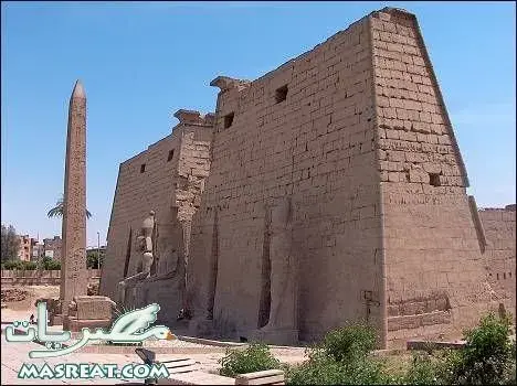
Once known as Thebes, Luxor’s importance in ancient Egyptian history cannot be denied. It was the religious capital for almost all of the Pharaonic period which is why the town is dominated by the two temples; The Temple of Luxor, and the immense Temple of Karnak; the world’s largest temple complex.
Dedicated to Amun Ra, the Temple of Karnak was constantly expanded by successive pharaohs, each adding his, or her, tribute to the god. The site dates back to the Middle Kingdom under the reign of Mentuhotep (11th Dynasty), but most of what can be seen today is from the New Kingdom. Other parts of the complex include sites dedicated to Mut, the wife of Amun Ra, and their son Khonsu.
Most people know that Luxor was once Thebes, but “Thebes” was not what the ancient Egyptians called it. Ancient texts show that it was called t-apt, which means “the shrine”, with the ancient Greeks calling it tea pie. The Arabs had problems with pronunciation and so it became Thebes to them. The name vanished then as the area submitted to the desert and then by the 10th century Arab travellers thought the ruins were of grand buildings so started to call it Al-Oksour, or “site of the palaces” which slowly became Luxor.
Today Luxor is split into two, by the River Nile, and these two areas are known as the East Bank (where the town lies) and the West Bank. Though this was also true in ancient times, the two parts were called the city of the living (East Bank) and the city of the dead (West Bank). Like most of the River Nile, the western side tends to be more desert, with the eastern side having far more arable land, and so settlement sites tended to favour this latter side.
Luxor is situated 670Km (416 miles) to the south of Cairo, 220Km (137 miles) to the north of Aswan, and 280Km (174 miles) to the west of Hurghada. It is the second most popular place to visit in Egypt, behind Cairo, and is accessible in a number of ways.
By flight:
Luxor International Airport is located 6Km (4 miles) east of the city and can be reached from most countries around the world, though it is most popular for charter flights. From here you can also fly to most of the main cities and towns in Egypt, as well as arriving from them. EgyptAir runs daily flights from Cairo to Luxor, as well as Luxor to Cairo, which take, on average, about 50 minutes.
By train:
Luxor is situated on the main Cairo to Aswan railway line and has a modern station in El-Mahata Square. Services to both Cairo and Aswan are very frequent, though restriction on tourists are in place right now which allows them to only use the sleeper service, or the trains either side of them.
By road
Though Luxor is connected by road to Cairo and has a good bus connection with the capital, tourists are asked not to attempt to use this mode of transport for this journey and are therefore left with only rail or flight as an alternative. The road to Aswan can be used though as it gives the opportunity to visit sites such as Edfu and Kom Ombo. Hurghada is reachable by a 3.5 hour bus journey, opening up the Red Sea for those who wish a change. Please note: if you do intend to use this mode of transport you are best booking your seats at least 24 hours in advance to ensure you get the seats you want.
By Cruise
Nowadays you can only go to Aswan by cruise boat, though some operators do offer the opportunity of a one day sail to see Dendera. The River Nile has not been used for cruises between Cairo and Luxor since the late 1990’s.
Coptic cairo
Cpptic cairo inculde the Coptic Museum, the Hanging Church, the Greek Church of St. George and many other Coptic churches and historical sites....
Cpptic cairo inculde the Coptic Museum, the Hanging Church, the Greek Church of St. George and many other Coptic churches and historical sites. It is believed that the Holy Family visited this area and stayed at the site of Saints Sergius and Bacchus Church (Abu Serga).Coptic Cairo was a stronghold for Christianity in Egypt until the Islamic era,
There is evidence of settlement in the area as early as the 6th century BC, when Persians built a fort on the Nile, north of Memphis. The Persians also built a canal from the Nile (at Fustat) to theRed Sea. The Persian settlement was called Babylon
It is traditionally held that the Holy Family visited the area during the Flight into Egypt, seeking refuge from Herod.[5] Further it is held that Christianity began to spread in Egypt when St. Markarrived in Alexandria, becoming the first Patriarch, though the religion remained underground during the rule of the Romans.[6] As the local population began to organize towards a revolt, the Romans,
Under the Romans, St. Mark and his successors were able to convert a substantial portion of the population, from pagan beliefs to Christianity. As the Christian communities in Egypt grew, they were subjected to persecution by the Romans, under Emperor Diocletian ar
Egypt
...
The country known as Egypt is officially called the Arab Republic of Egypt and it is situated in the north-east of Africa; though the Sinai Peninsula forms a land bridge with south-west Asia. It is because of this that Egypt is also called a Middle-East country. Therefore Egypt is a transcontinental country, which helps it in being a major power in Africa, the Middle-East, the Mediterranean, and the Muslim world.
In Arabic Egypt is called مصر, or Miṣr, and in ancient times the country was known as Kemet, or the black land, due to the alluvial soil which was deposited during the annual inundation of the River Nile. This yearly event gave Egypt its fertile land that enabled it to expand along the length of the river, especially in the Delta where many various crops were, and still are, harvested.
Egypt covers an area of approximately 1,001,450km2 (386,662 miles²) and is bordered by Israel and the Gaza Strip in the north-east; the Red Sea in the east; Sudan in the south; Libya in the west; and the Mediterranean Sea in the north. It is the 3rd most populous country in Africa and the most populous in the Middle-East with the majority of its estimated 80 million people living on, or near, the banks of the River Nile. Only 5.5% of the total land area is actually used by the population, the area that borders the River Nile as well as a few oases, the other 94.5% being uninhabitable desert.
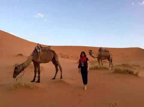
The River Nile vertically bisects the Sahara Desert and the area to the west is known as the Western Desert, or Libyan Desert, with the area to the East, as far as the Red Sea, being called the Eastern Desert. The desert itself is very sparsely inhabited with relatively small population centres growing up around oases such as the Fayoum, Siwa, Bahariya, Farafra, Dakhla and Kharga to the west and any areas of habitation being restricted to the many wadis (or valleys) to the east.
Within the Libyan Desert can be found an enormous area of sand which is known as the Great Sand Sea and located within this area are several depressions that have their elevations below sea level. These include the Qattara Depression, which covers an area of approximately 18,000km2 (7,000 miles2) and reaches a depth of approximately 133m (436 ft) below sea level: the lowest point in Africa.
Most of the Eastern Desert lies on a plateau that gradually rises from the Nile Valley to heights of approximately 600m (2,000 ft) in the east. Along the Red Sea coast there are many jagged peaks that reach as high as 2,100m (7,000 ft) above sea level. The Nubian Desert lies to the extreme south of the Eastern Desert, along the border with Sudan, and it is an extensive area of dunes and sandy plains.
The Sinai Peninsula mainly consists of sandy desert in the north with rugged mountains in the south; the summits here towering more than 2,100m (7,000 ft) above the Red Sea. Mount Catherine, or Gebel Katherîna, reigns supreme here at a height of 2,629m (8,625 ft) and is the highest point in Egypt, slightly dwarfing the nearby Mount Sinai, or Moses Mountain (Gabal Musa), at 2,285m (7,497 ft). According to Islamic, Christian and Jewish beliefs, the biblical Mount Sinai was the place where Moses received the Ten Commandments, though not everyone agrees that this particular mountain is actually the biblical one.
The River Nile is nowadays regarded as the longest river in the world and it enters Egypt from the Sudan and flows north for about 1,545km (960 miles) until it exits into the Mediterranean Sea. From the Sudanese border to Cairo, the River Nile flows through a narrow cliff lined valley, which, south of Edfu, is hardly more than 3km (2 miles) wide. From Edfu to Cairo, it is about 23km (14 miles) in width, with most of the arable land lying on the western side. Just north of Cairo the valley merges with the Delta before the River Nile joins with the Mediterranean Sea.
The Delta is a triangular shaped plain, bordering the Mediterranean coastline for approximately 250km (155 miles). Silt has been deposited here by the many tributaries of the River Nile (Rosetta [Rashid], Damietta [Dumyat] and others) and this has made the Delta the most fertile area of Egypt. The Aswan High Dam, however, has reduced the flow of the Nile, the annual inundation now being confined to history, and this has caused the salty waters of the Mediterranean Sea to erode most of the land along the coast. Nowadays a series of four shallow, salty, lakes extend along the seaward extremity of the delta.
Lake Nasser, the world's largest man-made reservoir, was formed by the building of theAswan High Dam in 1970. It is approximately 480km (300 miles) long and 16km (10 miles) across at its widest point. Almost two-thirds of this lake is situated in Egypt, and it extends southwards across the Sudanese border.
From ancient times, right through to the modern era, the Nile Valley has been divided into two separate regions, Lower Egypt and Upper Egypt. Lower Egypt, where the Pharaohs wore the red crown, is the area of the Delta, whilst Upper Egypt, where the Pharaohs wore the white crown, is the entire valley south of Cairo (or Memphis during the Pharaonic period).
The land boundaries, which Egypt shares with other countries, are 2,665 km in total and comprise of: Gaza Strip 11 km, Israel 266 km, Libya 1,115 km and Sudan 1,273 km. Its coastline is 2,450 km long which includes the Mediterranean Sea, the Red Sea, the Suez Canal and the Gulf of Aqaba, though any indentations, which are suitable as harbours, are confined to the delta.
Egypt has one of the most diverse economies in North-Africa and the Middle-East with the various sectors employing the following amounts of people: agriculture 32%; industry 17%; services 39%; and tourism 12%.
A predominantly Sunni Muslim country, Egypt has Islam as its state religion. A genuine estimate of the percentages of the various religions is a controversial topic in Egypt, and no two sets of figures appear to match, but it is generally accepted that 80-90% of the population are Muslims. Five times a day the "Adhan", the Islamic call to prayer, can be heard being broadcast from the loudspeakers on Cairo's many minarets. There are so many Mosques in the Egyptian capital that it was once dubbed "the city of 1,000 minarets".
Cairo also hosts a considerable number of church towers due to the Christian minority in Egypt, which makes up about 8-18% of the population. Of these, 90% belong to the native Coptic Orthodox Church of Alexandria with the other 10% comprising of the Coptic Catholic Church; the Evangelical Church of Egypt; and various other Protestant denominations.
The remaining 2% of the population are Jews, with a number of synagogues being sited around Cairo. Islam, Christianity and Judaism are the only three religions that Egypt officially recognises.
Egypt, as a unified country, is believed to have been created about 3,200BCE, though it is known that a civilisation existed here since the Neolithic period (8,800-4,700BCE) and perhaps as far back as the Palaeolithic period, though much of the dating of this period was done by uncalibrated radiocarbon dating.
Why the ancient people decided to settle on the banks of the River Nile is not known, though it is generally accepted that it is because of the Sahara Desert, which was once fertile, starting to change into a sandy expanse, forcing the population to look for water. Once the River Nile was discovered, the regularity and richness of the annual inundation, or flood, coupled with the semi-isolation that was provided by the deserts to the east and west, allowed for the development of one of the world's greatest civilizations.
The last indigenous dynasty surrendered to the Persians in 341BCE, who were then replaced, in turn, by the Greeks, the Romans, and the Byzantines. In the 7th century the Arabs introduced Islam, and the Arabic language, and ruled for the next six centuries until the Mamelukes, a local military caste, seized control circa 1250, continuing to govern after Egypt was conquered by the Ottoman Turks in 1517. Once the Suez Canal was completed in 1869, Egypt became an important world transportation hub, but this also caused heavy debt. Seemingly, to protect its investments, Great Britain took control of Egypt's government in 1882, but allegiance to the Ottoman Empire continued until 1914. By 1922 Egypt was partially independent from the UK and acquired full sovereignty, with the overthrow of the British-backed monarchy, in 1952.
The largest growing population in the Arab world, as well as limited arable land, and dependence on the Nile, have all contributed to the huge over-taxation of resources and has stressed society. The government had struggled to meet the demands of Egypt's growing population through economic reform and massive investment in communications and physical infrastructure until Jan 25th 2011, when youth led protests brought down the Presidency and government. Now the world waits to see how this new civilisation pans out.